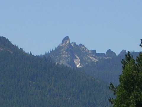
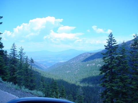
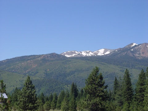
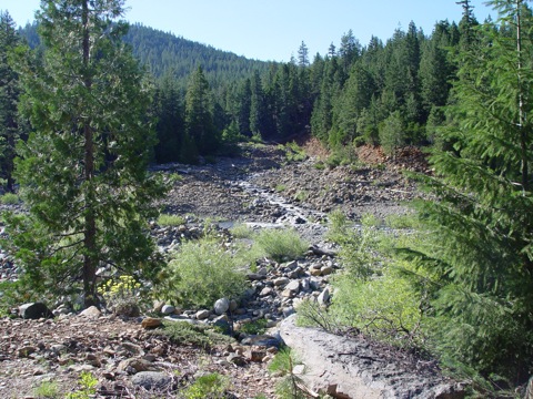
It's a good thing Teddy Roosevelt had the vision and
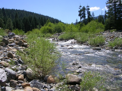
foresight to protect American forests like Shasta-Trinity - granite peaks and cliffs, canyons,
glaciers, rock pinnacles, and reflective lakes offer a solitude you won't find
inside any of California's sprawling cities. Here, the earth is raw and
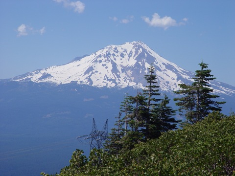
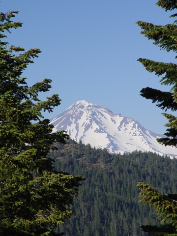
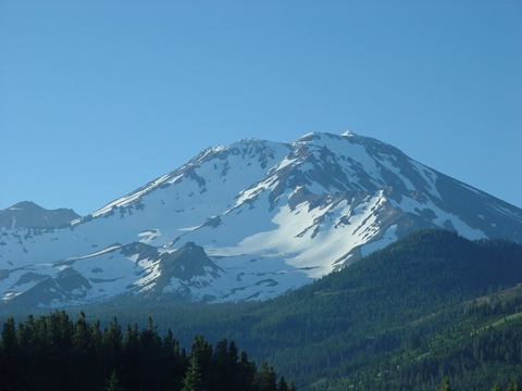
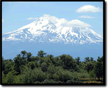
visceral; its power is palpable. As Mount Shasta looms in the distance, a plume
of sulfurous smoke serves as a reminder of the awesome energy that lies hidden
beneath the surface - at 14,162 feet, it is the second highest volcano in the Cascade Range.
Speak softly and carry a big stick, T.R. famously uttered -
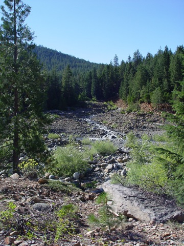
perhaps he meant a big hiking stick. Hikers can explore a labyrinth of trails
that meander through the forest - more than 1,400 miles of trails carve their way through
Shasta-Trinity. Those who enjoy the water can blaze their own trail on expansive
Lake Shasta which offers a world-class waterskiing environment.
Project
Description
The ArrowCorps5 Shasta-Trinity National Forest Project
(ASTP) is located in the Shasta-Trinity National Forest an hour drive through 60
miles of magnificent country side north of Redding, California. The California /Oregon
border is another 60 miles north. Interstate 5 (I5), a major north-south highway,
bisects the project into east and west sections, with the city of Mt. Shasta, at
an elevation of about 3600 feet, being at about the center of the entire project
elements.
The ASTP consists of several elements of work on the Pacific
Crest Trail (PCT), feeder trails to the PCT, illegal dump site clean-up, and fuel
reduction. The purpose of the project is to provide much needed assistance to the
National Forest with trail maintenance and clean-up that otherwise would not be
done. The projects require a range of abilities that should be sufficient to provide
all participants with a satisfying experience, while rendering a service to the
forest and future visitors.
To the East of the I5, there are two main elements of the project.
There will be standard trail maintenance done for the approximately 69 miles of
PCT from where is enters the Forest at Peavine Creek to the I5. Standard trail maintenance
provides restoration of the trail as needed, and could include installation or re-construction
of water bars, tread reconstruction, brushing, possible signage at trail intersections,
and restoration and/or construction of new erosion protective structures adjacent
to the trail. Additionally, there will be trail maintenance on the approximately
7 mile McCloud Loop Trail, which will include brushing, tread work and route markers.
Elevations along these elements of the project vary from 2200 feet to over 6100
feet. Preliminary planning indicates that this work will require approximately 21
crews, with 10 members in each crew.
West of the I5, there have been three trails identified as in
need of maintenance. Directly west of the I5, the PCT passes through the Castle
Crags Wilderness (CCW), with slightly over 15 miles of trail that needs standard
trail maintenance. All work in this area will be preformed with hand tools and/or
pole trimmers. No mechanical type of equipment will be allowed to be used on this
element of the project. Beyond the wilderness area, there is an additional 46 miles
of the PCT out to Bull Lake that will need standard trail maintenance. Additionally,
a PCT feeder trail slightly over 24 miles in length, known as the Sisson Callahan
Trail (SCT), in also in need of some heavy repair. Some of this trail, about 1.5
miles in length, has gullies 2 to 3 feet deep that will require intense rock work
to bring the tread back up and create lead off ditches through adjacent berms. The
elevation at the I5 starts these elements of the project off at 2200 feet and can
get over 7600 feet, with the average at around 5500 feet. It is presently planned
that 4 crews will be needed for the trail within the wilderness, 12 teams on the
balance of the PCT, and 18 crews on the Sisson Callahan Trail work.
The final trail project is the construction of a new South Gate
Trail at Panther Meadows, north of the city of Mt. Shasta. This 1.1 miles of trail
is partially in the Mt Shasta Wilderness and is presently in the environmental evaluation
and permitting cycle. It is hoped that the approval process will be completed in
time for 2 crews to construction this new trail at a 6500 foot level.
In addition to the trail work, other projects have been identified.
Two of the projects will involve the removal of illegally dumped materials in the
forest, normally adjacent to accessible roads, within a five miles radius of the
towns of Mt. Shasta and Weed. Presently there are 6 crews anticipated for the week
long project to clean-up the majority of the sites.
Additional projects have been identified, but are presently
in the preliminary stage of definition. They involve maintenance on buildings within
the forest and removal of brush from a publicly accessible area of the forest
Project Schedule It is anticipated the participants will arrive during the day on Saturday,
July 12, 2008, register and get all of the form and check-in work completed, and
get themselves situated in quarters for the next two nights. On Saturday evening,
an opening campfire will start the project off. On Sunday there will be participant
training, distribution of materials, and organization of the crews for the elements
of the projects. Each Strike Team will consist of twenty (20) people, plus one Strike
Team Leader. Additional positions within each team will include a safety officer
and other possible positions that will be identified in the future as planning proceeds.
In some instances, team members will wear multiple hats.
Monday morning will be a concentrated effort to get all of the
teams into the field with all of their gear that they will be carrying. Due to high
degree of logistics to move people and equipment into the field over a wide area,
the Shasta Trinity Project command staff has elected to provide all of the staff
a single day of recreation. Thus, all teams will returned to the central camp area
for a day of recreation on Friday, with a closing campfire that evening. Participants
will depart on Saturday, July 19th for their return home.
Project Support For the initial registration and check-in activities, campfires, the first
two nights, and the last night on the project, all participants will be housed at
a centralized camp facility. It is anticipating that the crews involved with the
trail re-construction and/or construction will be camping on the trail during their
time in the field, cooking their own meals, with the food provided by the project.
Some of the trail work crews may be able to be supported at a "spike" camp out on
the trail, if their location lends itself to that type of accommodation.
The dump site clean-up project, and possibly other projects
near or around the Mt Shasta general area, may be supported from the central camp.
All support staff will be housed and supported at the central camp. Further planning
is needed to determine exactly where each crew will have their housing and support,
or be able to be supported by the central camp.
We anticipate that we will have support personnel and/or groups
to distribute tools into the field for the crews. They would also assist with the
registration and check-in process, transportation of the crews, or crew equipment,
to their drop off points, and various other jobs that will support the over all
project. Most of the support staff will have multiple jobs during the executions
of the project elements.
Statistics Shasta Trinity ArrowCorps5 Project consists of six major components:
116.2 Miles on maintenance work on the Pacific Crest
Trail. There are 47.4 miles west of the I5, with 17 possible trail access point,
and a maximum distance between any two access points being 10.9 miles. There
are 68.8 miles of the PCT east of the I5, with 41 possible trail access points,
and a maximum distance between any two access points of 9.7 miles.
17.9 Miles of maintenance work on the Sisson Callahan
National Recreation Trail - there is approximately 1.5 miles of heavily damaged
trail (ruts 3' to 4' deep, and major water bar re-construction needed). There
are 13 possible access points, and the maximum distance between any two access
points is 5.2 miles.
The McCloud Loop Trail is a 16.8 mile trail directly south
and parallel to State route 89, between McCloud and Kinyon. It passing
through six campground and three picnic areas while following the McCloud river.
There are 21 possible access point to this trail, with the maximum distance
between any two points being 3.6 miles.
The South Gate Trail at Panther Meadows will be the only
new trail that the project will construct. This 2.3 mile segment will replace
an existing rail through a pristine meadow by skirt the edge of it. This work
will take place at the base of Mt Shasta, mostly in the dedicated wilderness
area.
The next two projects are the removal of existing dumped
household waste goods materials on the back road (normally dirt roads) within
radius of the towns of Weed and Mt Shasta. We are still in the process of determining
how may miles of road this will cover.
Additional projects have been identified, but are presently
in the preliminary stage of definition. They involve maintenance on buildings
within the forest and removal of brush from a publicly accessible area of the
forest.
In all we have over 153 miles of trail maintenance
or new construction work, and illegal dump clean up in nearly 150 square miles of
back roads around two towns.
Recreational
Opportunities
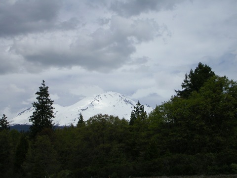
Mount Lassen Volcano Excursion Take a leisurely
excursion throughout the rugged and historic volcano, nestled in the gorgeous
Cascade mountain range. All of this within only 2.5 miles and 2-4 hours.
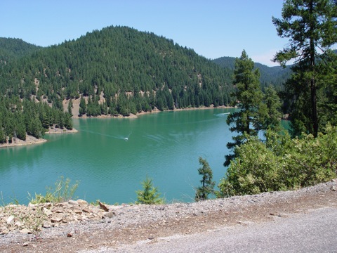
Lake Activities Canoeing, kayaking, pontoon
boating, and fishing, is there anything better? I say there is, and I believe
you will too when you sample them all in one day along with the afternoon Beach
Bash.
Caving Though the liquid hot magma has
gone from this region, the Shasta lava caves are still something to wonder.
Tap into your inner adventurer and discover the mystery that awaits.
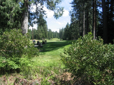
18-Hole Golf You'll have to take
your skills to the nth degree to compete on this course. Enjoy this 18-hole
resort course as you take in the scenery and the eagles.
Afternoon Activity
Blissful Beach Bash Indulge yourself with
the plethora of fun events in the pleasant warmth of the afternoon sun. California
has long been known as the beach culture of America along with fun, food, and
fellowship.

 Shasta-Trinity
National Forest
Shasta-Trinity
National Forest